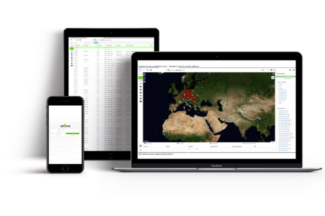
Anitra Web Platform
a single place for all the projects and devices
about the tool
- dashboard for Anitra device pool
- telemetry project management with elaborated data distribution scheme
- data visualisation in maps, timeline, grids, animations and graphs
- field support functionality
- data connectors from/to other data sources
functionality
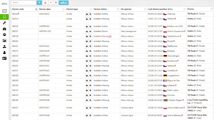
- Dashboard for Anitra devices
- status overview of active devices
- device configuration management interface
- customer financials (communication charges and payments)
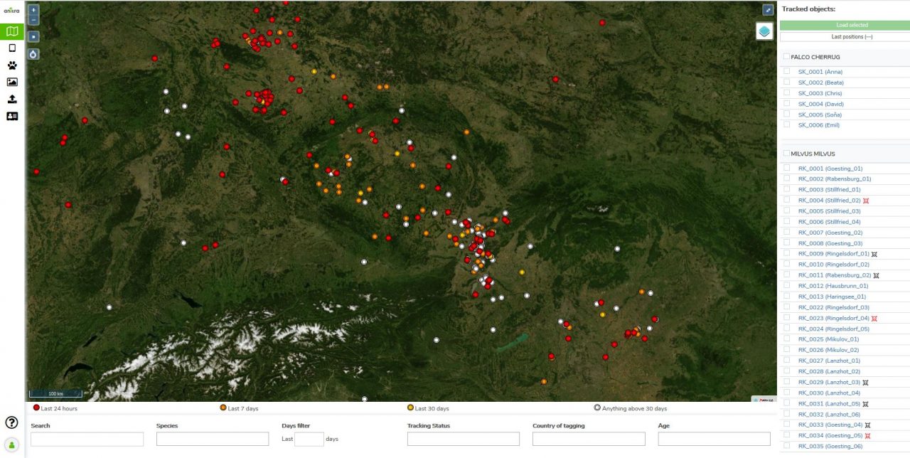
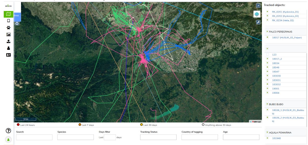
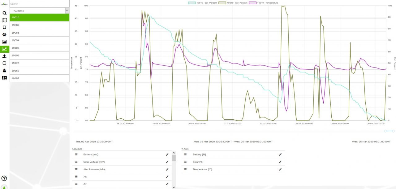
- GPS and sensor data visualisation/analysis in maps, timelines, grids, and graphs
- map view: points, paths, movement animation etc
- detailed data visualization functionality in profiles (complex table - map - timeline view)
- combined view of multiple tracked animals in the main map functionality
- advanced data analysis and automated post processing (e.g. mortality warnings, geolocation, data clustering, filtering or correction etc.)
- Complex project management and data sharing sheme
- the concept of devices and trackings (i.e animals) allows the possible split of device data into more tracked individuals and masking irrelevant data (before/after the actual tracking of the animal)
- custom filters allow group the devices and trackings into "projects"
- rich Device and Animal metadata (including dates, IDs, species, sex or age classification)
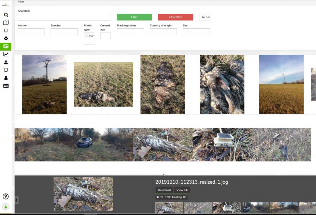
- Tracking/animal related photo galleries, attachments
- Elaborated data distribution scheme including admin management configuration rights , rule-based sharing and ON-line web publishing
- advanced data filtering available when sharing or publishing data - (e.g midnight positions only, security zones (i.eg. trimmed paths or blurred positions when near to the nest), location based sharing (e.g active data for animals currently in a particular country are dynamically shared and displayed with local teams)
- event triggered warnings and notification (e.g. new data delivered, mortality detected or recent close up to POI)
- Fieldwork support functionality (such as checking the animal, looking up the dead individuals, photo documentation etc.).
- current user position in Anitra tracking map together with device data
- auto clustering of scatterd GPS positions (e.g. when localizing the logger / dead animal)
- saving user tracking data such as Points and Tracks in user folder for further use or sharing with others
- requesting onetime communication ahead (e.g. data to be updated when visiting the locality)
- Data processing and Integration
- real-time collection and analysis of ANITRA native data
- ON-line data feeds from other device producers and environments ready to use (Movebank, Onitela, Ecotone etc)
- flexible manual integration of datasets from various other sources and formats (Argos, flat file, KML etc.
- manual data export functionality (csv, xlsx, kmz, gpx, movebank)
- automated data access over API
- Anitra to Movebank live data feed
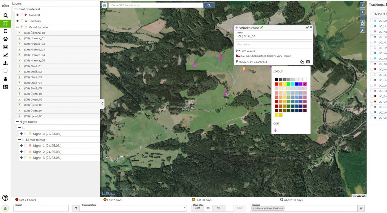
- Custom Points of Interest (POIs) database building and sharing - advanced data visusalisations or "geofencing" with Anitra tags
- naturally arises as a by-product of device/animal metadata completion enrichment process
- advanced use: intentionally and systematically gathered geolocation data of various types
- existing external databases (e.g. nests, mortality places, migratory bottlenecks, wind parks/turbines etc) can also be integrated and used
- POIs can be used for advanced geofencing onboard of tracking devices, as support map layer while displaying tracking data or to trigger a notification when TO is approaching or leaving the area of interest (e.g. start of migratory movement)
- Published maps output - a useful way to present your telemetry results as simplified and secured live maps
- various background map layers
- custom names, order and colors of presented tracks
- embedded fotogallery related to dispalyed objects
- logos of project partners including links to their web sites
- output as a link to map iframe and/or in form of HTML code which can be simply embedded in the organisations website
- security features such as limit on map zoom level, filtered and rounded positions, update delay etc.